Tuesday, December 15, 2020

When should we go?


When is a personal choice, of course.  

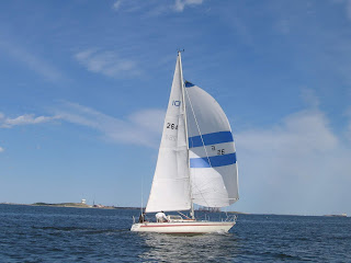
A quick story on the topic.  The boat pictured is our 48 foot Alden designed yawl, THETIS ex Hermita.  She was built in 1921 by Pendleton in Wiscasset, Maine.  Mom and dad bought the boat in the winter of 1958 and refitted her for a voyage to the Bahamas which we began in 1960.  I was 10 and my siblings were 9, 7 and 3.  Mom and dad were 34 years old.  They had been saving for and planning the cruise since before marriage.


So, what's the right age to go cruising?  I think it has more to do with when you are ready than how old you are.  As a now 70 year old, the upper limits are talking to me.

While cruising, we met a lot of cruising families with kids our ages and parents who were contemporaries of my parents.  I remember the yacht names, Black Dragon, Black Pearl, Caravan, and Falcon plus a few others that slip my mind.  I remember the times as having more and better friends while cruising than while living on Cape Cod.

Ready. Set. Go.


Tuesday, February 25, 2020

Cost of cruising?

A topic I study with some care.  Some links to vlogs and blogs will follow.

To start, let's consider a factor that is seldom discussed: "Is cruising more expensive than living ashore?"  Is cruising more expensive than...?  The old "compared to what" discussion.  My study and personal experience is that it is not more expensive to live aboard and cruise than live ashore and do whatever it is shore dwellers do.  Of course, it can be.  That's because the cruiser chooses to make it so.  I suppose one choose to live on less and make cruising less expensive than living ashore.  "Compared to what" is a function of choices.

Looking at where I live, a moderate house costs about $400K and a typical household spends from $6 to $10K a month to live.  That's including mortgage, maintenance, taxes, utilities, food, entertainment, vehicles, insurance and so on.  This is a nice place to live with plenty to do and work if you want it.  A nice cruising boat is about $100K and cruising costs run around $3K a month.  Is cruising expensive?  You decide.

As cruising sailors, we'd probably live the same way we do ashore and spend less than living ashore.  We'd live in an inexpensive cruising area, exploring ashore on foot.  We already do that where we live and also have higher expenses.

As a charter boat skipper, I see guests spend up to ten grand for a week of sailing.  Hardly the typical cruising family life style.  Probably why the image of cruising as expensive is so skewed.  Likewise, I meet cruisers who are tied to a dock performing repairs on their complicated yachts.  Simplify?

My parents cruised almost all of their lives, more after the kids moved out!  They said the cost of living afloat and living ashore were about the same.  It is just the way one lives that affects the cost of living.  They were teachers.

Suggestion for managing costs: start with a well prepared yacht that is simple in its maintenance requirements and then maintain the yacht yourself.  Simplify, simplify, simplify.

https://sailingsoulianis.com/
Maybe the most comprehensive contemporary blog on the subject.

These YouTube videos contain some useful information about the cost of cruising:

Sailing Magic Carpet:  https://www.youtube.com/watch?v=RKL-gO9946c&t=173s

Sailing Doodles:  https://www.youtube.com/watch?v=Qkdt7zx_bS4&t=30s

Ryan and Sophie Sailing (three parts examine three boats):  https://www.youtube.com/watch?v=UM5iRHDEXPM and https://www.youtube.com/watch?v=vMGW3XEImjI&t=745s and https://www.youtube.com/watch?v=ZxJQIiV1nnI

Sailing Kittiwake:  https://www.youtube.com/watch?v=r9DjSOLCxTM&t=169s

Sailing Balachandra:  https://www.youtube.com/watch?v=ZbD_hPe_biE

Some blogs I have found useful are:
https://www.youtube.com/watch?v=E82-doOJezU

http://svbebe.blogspot.com/p/costs.html

http://thegiddyupplan.blogspot.com/2011/04/cost-of-cruising.html

http://lifeafloatarchives.blogspot.com/2012/04/cost-of-living-afloat.html

http://www.mid-lifecruising.com/p/expenses.html

More to follow...

And then, how different is cruising from life ashore is nicely described by the Magic Carpet couple
https://www.youtube.com/watch?v=orTfSy7lm24


Monday, December 16, 2019

Latts and Atts

Tip of the hat to Bob Bitchin and staff.  This site is listed on their web site which is a surprise and an honor.

https://latsatts.com/

I am going to add some sailing pictures to their site, too.

A seasonal picture, first snow on Cape Cod in December 2019:


Wednesday, April 17, 2019

Celestial Navigation: Sight Reduction

work in progress...
I need some good days for photographing the sextant work.
9 May 2019, sunny but I had a conflict.
Norm

The Nautical Almanac is the one book required for sight reduction by hand.  The single volume Nautical Almanac is required when using other tables such as HO 211 or HO 249. Since the Almanac includes a set of tables and the useful forms required for sight reduction, no other books are required.

An excellent tutorial is available on YouTube here:
https://www.youtube.com/watch?v=gucO6eVtwVo&t=4s


Let's look at the NAO Concise Sight Reduction Form. In the 2019 Nautical Almanac, it is on page 319.


The instructions for using the pro-forma are found on pages 277 through 285.

The first two things a navigator needs are time and angle.  See my notes on that in an earlier post.  Once the time and altitude are captured, the calculation using the Almanac is not too complex.

Step 1.   please wait.


Wednesday, December 5, 2018

Voyager Notes: Section 0: Overview


Sailing schools offer ocean voyaging classes and experiences. These sections entitled "Voyager Notes..." are designed to help candidates as they pursue the ASA 108 program. The material is mine and mine alone. It is based on my experience and does not reflect anyone else's views.  The following pictures and comments are a bit about who I am.

Enjoy, comment, suggest corrections and amendments.

Norm
Harwich MA

Our boat, Averisera

Averisera and a Cal 33 we frequently raced. Both on Boston Harbor

In cruising mode at the Black Dog Wharf in Vineyard Haven

In Provincetown after an overnight double handed race we did not win

Shortly afterwards a squall blew through and destroyed the kite.
2007

Looking for wind on a windless day

Home during the years 1959 and 1962
Thetis

We built the Skerry from Chesapeake Light Craft kit

Voyager Notes: Section 1: Planning a Voyage, an Atlantic Circle

From the ASA's 108 standards, skills 1 and 2


1.Plan a passage across the North Atlantic or Pacific and state the advantages, disadvantages and hazards of various routes, utilizing Ocean Passages for the World, climatic charts, Great Circle plotting charts, plotting instruments, etc.
2.Plot a series of rhumb lines on a Mercator chart to approximate a great circle route.

Our plan is to sail from Newport, RI to Horta, Azores using a 35 foot seagoing sloop.  

The Azores are most of the way across the Atlantic and on the route to Gibraltar and the Med. It is over 2300 nm from New England which is about 16 days at an average speed of 6 knots or 20 days at an average of 5 knots. I'd plan on 20 days!

Let's discuss charts. We will use a Mercator Chart, pilot chart, and a Gnomonic chart. Each has it purpose.

 At the outset, let's make Plan A: the top shows two of the possible planning tracks. On the Mercator Chart, the pictured pilot chart, the great circle route plots as a curve, white pins. The great circle route goes into the cold reaches of the North Atlantic north of the Gulf Stream. The warmer and somewhat longer route is plotted as a curve to the south of the rhumb line. Advantages are warmer water, a fair current, and favorable wind direction and strength. The dark pins mark the route this sailor prefers, Plan A.


Pilot Chart for North Atlantic in June

The catalogue of pilot charts shows average conditions for each month.  Other considerations are things such as hurricane season in the Atlantic, July through November.  Hurricanes are most likely in August through October which makes those poor months for North Atlantic voyaging.  Other oceans have other severe weather seasons.  Seldom discussed is the risk of prolonged periods of calm.  No wind is a severe condition for a sailing vessel.


 A view of the big picture. 


A closer look at the Gnomonic chart comparing the Great Circle Route (straight line with flags) to the straight line on a Mercator chart (curved line marked with pins). The pined route keeps the heading constant at 093 degrees True. On the top chart, our desired route is planned out to be below the rhumb line defined by the blue pins (see above chart). It is longer and more comfortable.

Once we arrive at Horta, Azores, what are we doing next? Aside from cruising the islands, how about another voyage? Maybe an Atlantic Circle? (If you can get the book Atlantic Circle by Kathryn Lasky-Knight, do so. True story about a young couple a long time ago in a small boat and eventually with a little kid.) 

Using pins on the Gnomonic chart, the Atlantic Circle is detailed. The regulator of the trip is the Atlantic Hurricane Season, July through November. One must not be too far west as hurricanes brew off the Coast of Africa. Madera, The Canaries, and Cape Verde Islands  are for lingering until the crossing season starts in late November or early December. A first landfall in Barbados, for example.  That starts the Caribbean cruising circuit which ends somewhere in May with a run to Bermuda and then into home waters off New England.


The Atlantic Circle

Voyager Notes: Section 2: Reading and Reference

ASA 108 Level Skill Standard 3:
3. Describe the publications required for prudent navigation on an offshore passage including:

The navigation station requires some basic books and materials. The Nautical Almanac and a sight reduction table compliment the sextant. For a sight reduction several choices are available.  Learning, I used HO 211, Ageton, so that's pictured.  The sight reduction tables in the Nautical Almanac work fine so only that one book is required which saves space at the navigation table. The publications HO 229 and HO 249 are also commonly used though the three volumes take up a lot of space. Along with the books you'll need a notebook, plotting sheet, chart, etc.

Also included are two books by Jimmy Cornell: World Cruising Routes and World Cruising Essentials.


Cruising guides are invaluable to the voyager. Guides for popular sailing destinations are easy to find. Other areas, such as the Azores are more difficult. A hiking guide might be the best you can find. More than one world cruiser has been glad to have aboard a simple tourist map to help arrive at an unplanned harbor.